🏡 Basic Details
Pombur is a rural village and gram panchayat in Vanur Taluk, Viluppuram District, Tamil Nadu.
- Village Code: 632795
- Pincode: 605652
- Taluk HQ: Vanur (~18 km away)
- District HQ: Viluppuram (~25 km away)
- Total Area: 581.7 hectares (~5.8 km²)
- Coordinates: Close to the border of Puducherry UT
- Post Office: Vikravandi (serves Pombur)
🌾 Land & Geography
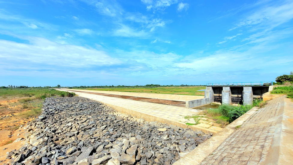
Pombur lies on flat, fertile plains of northern Viluppuram District and is close to the coastal zone.
- The village has a mix of agricultural land, residential plots, and water tanks used for farming and livestock.
- The climate is semi-arid with coastal influence; farming depends on borewells, monsoon, and seasonal canals.
👪 Population (2011 Census)
- Total Population: 3,994
- Males: 2,004
- Females: 1,990
- Children (0–6 yrs): 446 (~11%)
- Number of Households: 961
- Sex Ratio: 993 females per 1,000 males
- Child Sex Ratio: 948
📚 Literacy & Education
- Overall Literacy Rate: 78.1%
- Male: 86.3%
- Female: 70.0%
- Schools in Pombur:
- Panchayat Union Primary School
- Pre-primary facilities
- Nearby Schools: Secondary education accessible in Elayandapattu, Vikravandi, or Viluppuram
⚙️ Occupation & Workforce
- Total Workers: 2,220
- Main Workers (full-year): 1,541
- Cultivators: 643
- Agri Labourers: 721
- Household Industry: 23
- Other Jobs: 154
- Marginal Workers (seasonal): 679
- Main Workers (full-year): 1,541
- Farming is the primary occupation, focused on paddy, sugarcane, groundnut, and millets.
🏠 Streets & Localities
The village is organized around several hamlet streets and public paths:
- Main Street
- Amman Kovil Street
- Agricultural Field Lines
- Tank Bund Side Streets
Landmarks include:
- Mariyamman Temple
- Vinayagar Temple
- Ration Shop
- Water Tank
🏥 Health & Public Facilities
- Primary Health Centre: Nearby in Elayandapattu or Vanur
- Anganwadi Center for maternal and child health
- Water Supply: Tap water + borewells
- Electricity: Available for homes and agriculture
- Internet: Jio and BSNL tower signals present
- Shops: Grocery, saloon, mobile recharge, tea stalls
- Panchayat Office & Community Centre: Near Mariyamman Kovil Street
🚍 Transport & Connectivity
- Public Bus Stop: Inside village
- Private Buses: Operate to Vanur, Vikravandi, and Viluppuram
- Nearest Railway Station:
- Valavanur (~11 km)
- Vikravandi (~12 km)
- Viluppuram Junction (~25 km)
- Road Connectivity: Good interior village roads connect to NH-32 and Puducherry/Viluppuram routes.
🎉 Festivals & Recreation
- Panguni & Aadi Festivals at Mariyamman Temple
- Thee Midhi Thiruvizha (fire-walking)
- Common games include kabaddi, cricket, and volleyball, usually played near the temple grounds or tank bund.
🧭 Nearby Villages
- Elayandapattu (~1.1 km)
- Idaiyapattu (~2 km)
- Siruvai (~1.8 km)
- Iveli, Nemili, Tollamur, Panruti Road Line
✅ Summary
Pombur is a thriving agricultural village located near the Puducherry–Tamil Nadu border in Vanur Taluk, Viluppuram. With nearly 4,000 residents and high literacy (78.1%), the village shows good infrastructure, strong agricultural engagement, and civic connectivity. Its traditional temples, road links, and fertile fields make it a well-rooted community with scope for more rural development.
